SKYTECH Standard Scheduled Multirotor Drone Related Trainings and Customized Trainings (As per the requirement of customer)
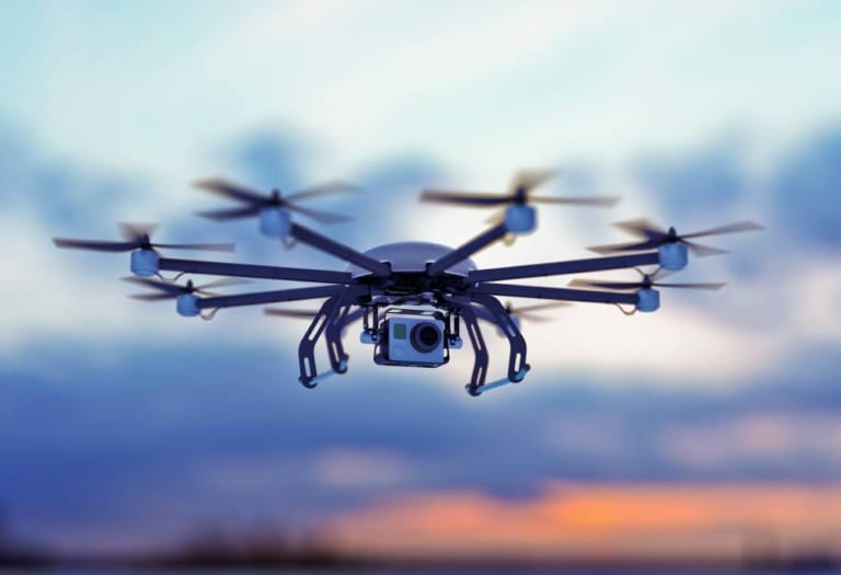
Aerial Videography & Photography
Aerial videography and photography using drone technology offer a revolutionary perspective that was once only achievable through expensive and cumbersome methods like helicopters or cranes. Drones provide unparalleled advantages, including high-quality imagery, cost-effectiveness, and accessibility.
They allow capturing breathtaking views and precise angles, ideal for real estate marketing, event coverage, film production, and even agricultural or industrial surveys. Additionally, drones can navigate hard-to-reach areas, ensuring safety and efficiency in capturing content from elevated or hazardous locations.
We, “Sky Tech UAV Flying Academy (Pvt) Ltd” offers professional drone-based aerial videography and photography services. Leveraging advanced drone technology and skilled operators, Sky Tech ensures top-notch results tailored to client needs. Whether it’s cinematic footage, real estate showcases, or industrial documentation, our expertise guarantees exceptional quality and reliability in every project.
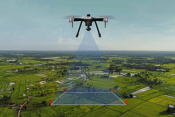
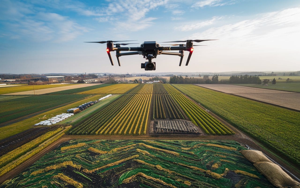
Precise Aerial Survey & Mapping (RGB, IR, Multispectral & LiDAR)
Drone-based Precise Aerial Survey & Mapping using RGB, IR, Multispectral, and LiDAR technologies offers unparalleled accuracy, efficiency, and cost-effectiveness. These advanced techniques enable detailed data collection over large areas in a fraction of the time required by traditional methods. Benefits include high-resolution imaging, the ability to access hard-to-reach locations, and the generation of actionable insights for industries such as agriculture, construction, forestry, and urban planning.
We “Sky Tech UAV Flying Academy (Pvt) Ltd”, specialize in providing professional Drone-based Precise Aerial Survey & Mapping services. Our expertise ensures accurate, reliable, and industry-standard results tailored to meet your project needs.
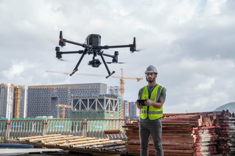
Aerial Site Monitoring & Inspections (Constructions/Cable Lines/Towers/Solar Farms/Work at Height)
Drone-based Aerial Site Monitoring & Inspections offer a safer, faster, and more cost-effective alternative to traditional methods. Drones can easily access hard-to-reach or hazardous locations, providing real-time, high-resolution data for constructions, cable lines, towers, solar farms, and work-at-height projects. This technology enhances operational efficiency, reduces downtime, and minimizes risks while ensuring detailed and accurate assessments.
Sky Tech UAV Flying Academy (Pvt) Ltd, specialize in professional drone-based aerial site monitoring and inspection services tailored to meet the unique needs of our clients. Whether it’s construction sites, cable lines, towers, solar farms, or work-at-height inspections, our advanced UAV technology and expertise ensure reliable and high-quality solutions to support your operational goals.
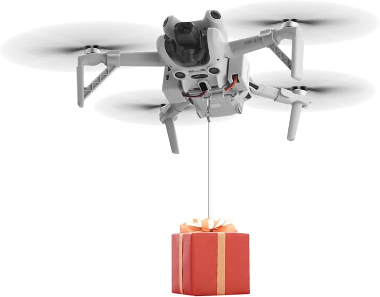
Aerial Cargo Delivery & Dropping (Flowers/Candy Dropping)
Drone-based Aerial Cargo Delivery & Dropping offers a unique, efficient, and innovative way to transport and distribute items like flowers and candy. This method ensures precise delivery, dropping while creating more attractiveness of your religious event. Additionally, it is ideal for special events, celebrations, and promotional activities, adding a creative and memorable touch to any occasion.
We provide professional Drone-based Aerial Cargo Delivery & Dropping services. Our expertise ensures safe, accurate, and spectacular deliveries to make your events truly unforgettable.
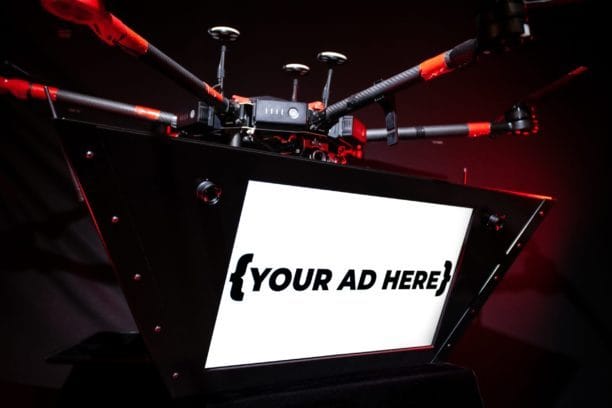
2D & 3D Digital Aerial Advertising & Displaying
Drone-based 2D & 3D Digital Aerial Advertising & Displaying, including hologram fan technology, offers a cutting-edge and captivating way to showcase brands, messages, or visuals. This innovative method ensures wide visibility, dynamic presentations, and a memorable audience experience, making it ideal for events, promotions, and campaigns. Drones add versatility and mobility, enabling displays in various locations with stunning visual effects.
At Sky Tech UAV Flying Academy (Pvt) Ltd, we provide professional Drone-based 2D & 3D Digital Aerial Advertising & Displaying services. Our expertise ensures impactful and high-quality solutions to elevate your brand and captivate your audience.
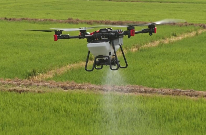
Precise Agriculture Aerial Spraying & Spreading
Drone-based Precise Agriculture Aerial Spraying & Spreading revolutionizes modern farming by offering speed, accuracy, and efficiency. Drones can cover large areas quickly, apply pesticides, fertilizers, or seeds with pinpoint accuracy, and reduce resource wastage. This method minimizes environmental impact, lowers costs, and enhances crop yield by ensuring even distribution, especially in challenging terrains or hard-to-reach areas.
At Sky Tech UAV Flying Academy (Pvt) Ltd, we provide professional Drone-based Precise Agriculture Aerial Spraying & Spreading services. Our expertise ensures reliable and effective solutions to boost agricultural productivity and sustainability.
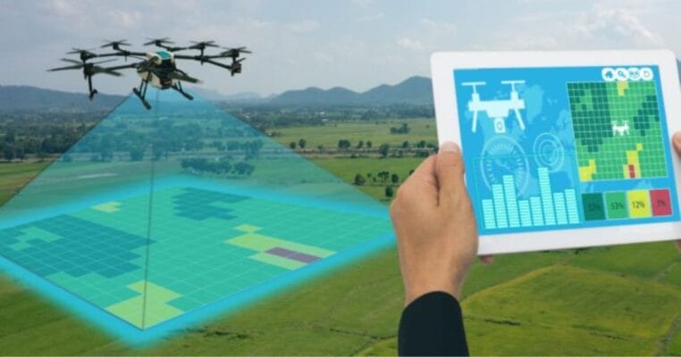
Agriculture Related Data Collection (Multispectral)
Drone-based Agriculture-Related Data Collection using Multispectral imaging offers significant advantages in precision farming. Drones can capture detailed multispectral data, allowing farmers to monitor crop health, detect pest infestations, assess irrigation needs, and evaluate overall field conditions. This technology enables early detection of issues, leading to timely interventions, improved crop yields, and optimized resource usage. It also saves time and reduces costs compared to traditional methods.
At Sky Tech UAV Flying Academy (Pvt) Ltd, we provide professional Drone-based Agriculture-Related Data Collection (Multispectral) services. Our expertise ensures accurate and actionable insights for enhanced farm management and productivity.
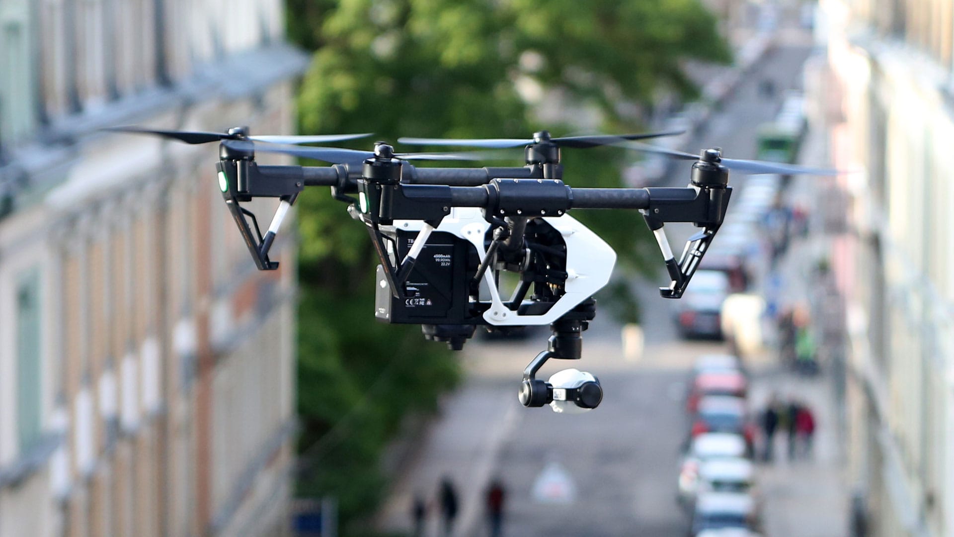
Aerial Surveillance & Reconnaissance
Drone-based Aerial Surveillance & Reconnaissance offers enhanced security, real-time monitoring, and detailed data collection across vast or difficult-to-access areas. Drones provide high-resolution imagery, thermal or infrared imaging, and live-streaming capabilities, enabling effective monitoring of critical sites, border/fence patrols, or emergency response areas. This technology improves situational awareness, reduces risks, and ensures rapid deployment in various surveillance scenarios.
At Sky Tech UAV Flying Academy (Pvt) Ltd, we provide professional Drone-based Aerial Surveillance & Reconnaissance assistance services. Our expertise ensures reliable, efficient, and secure monitoring solutions tailored to your specific needs.
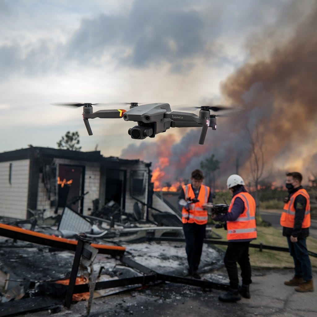
Disaster Management Assistance (Pre, During and Post)
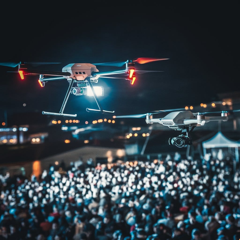
Event Management & Crowd Controlling
Drone-based Event Management & Crowd Control offers enhanced oversight, safety, and efficiency at large events. Drones provide real-time aerial monitoring, allowing for quick identification of crowd movement, potential hazards, and security concerns. They offer a bird’s-eye view that enhances event planning, logistics, and emergency response. Drones can also deliver aerial light displays at night, adding a unique visual element to events. This technology ensures smoother crowd management, better crowd safety, and a memorable event experience.
At Sky Tech UAV Flying Academy (Pvt) Ltd, we provide professional Drone-based Event Management & Crowd Controlling services both day and night. Our expertise ensures seamless event operations, improved safety, and effective crowd management solutions.
Data Processing & Analyzing (RGB, LiDAR & Multispectral)
Maintaining of Drone Services Related Marketing Platform/Hub
Maintaining a Drone Services-Related Digital/Virtual Marketing Platform/Hub is essential for efficiently connecting service providers and customers, ensuring that both parties can meet their specific requirements in a seamless, professional manner. This platform acts as a central hub for discovering and coordinating drone services, facilitating easy communication, service bookings, and real-time updates. It helps customers find tailored solutions, while service providers can showcase their expertise and capabilities to a wider audience.
We maintain a professional Drone Services Digital/Virtual Marketing Platform/Hub that ensures effective coordination, improved customer service, and optimized service delivery for all your drone needs.

